
General Information: Alternative trails that run along the forest tracks established in the Monte de Boadilla, and the municipality's bike path.
Length: 19 km.
Aproximate duration:
- 9km route in Monte de Boadilla
- 16 km on bike path in Boadilla.
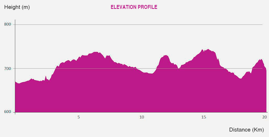
Elavation: 651-732 MASL.
Average grade: 2,5 - 3,5%, maximum: 14,5%
Accessibility: Bicycle parking stations and BIBO municipal electric bike rental, using a card, along the bike path.
Before discussing this bike trail, it is worth underscoring the need for an adequate balance between public use of the woodland and its conservation, so it is necessary to be aware of the effects that the improper use of bicycles can entail. Hence, you are encouraged to ride on the designated bicycle paths, and to avoid narrow ones. Monte de Boadilla regulations prohibit blazing new trails between the vegetation, as this does damage to it, while leading to erosive processes and negative effects on the populations of animals inhabiting woodland areas.
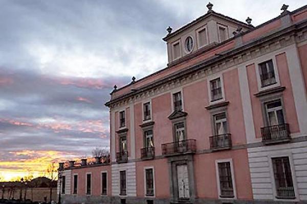
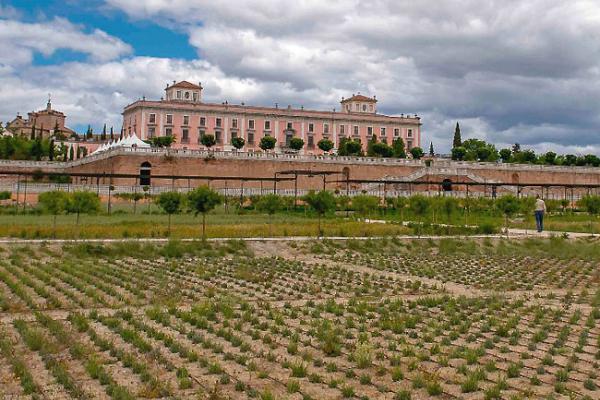
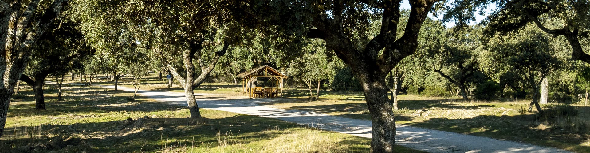
The Monte de Boadilla bicycle path consists of two ring routes that run along the forest tracks tracing the perimeter fence of the woodland area and that connect, at the Aula Medioambiental (Environmental Classroom) with the Boadilla bicycle path network. This route can be started at any of the access points to the woodland, although it is most convenient from the parking lot of the Palacio del Infante Don Luis, or from the aforementioned Classroom.
From this point, the route heads in the direction of the roundabout of the Pozuelo highway, from where users take the mixed-use path for pedestrians and bicycles that runs parallel to the Arroyo de la Fresneda, until the municipal sports center. Along this section, be sure to pay special attention and ride with caution, as you will come across many people walking, and there are also exercise facilities, so the area is busy. When you reach the dog park by the sports center, you can cross the wooden bridge and into the Monte Sur, from where you can take one of the trails designed for cyclists, or cross the highway and return along the mixed-use path parallel to it, until the entrance to the Monte Norte.
If you select this second option, upon entering the woodland you will face a short but steep climb towards the Cerro de la Mira overlook, from where the route runs to the Majadahonda highway through a scattered oak grove, allowing you to enjoy beautiful views of Boadilla's historic center. Continuing along the trail, it turns northeast for 3.5 km, parallel to the M516 highway, always inside the perimeter fence, such that vehicles pose no danger.
Upon reaching the Los Fresnos housing development, the route turns again, descending towards the Pradolargo path, in an area rich in holm oaks and stone pines.
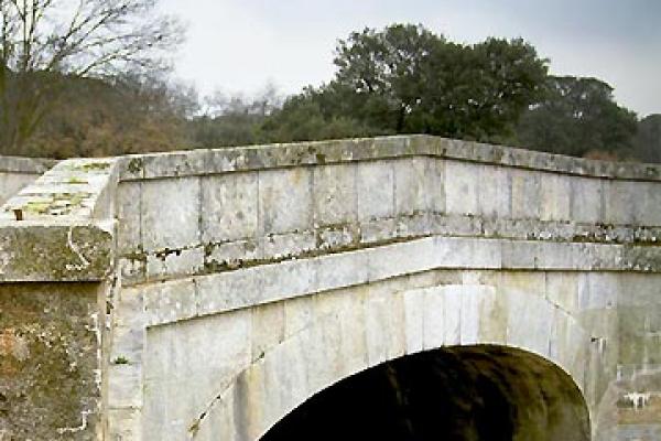
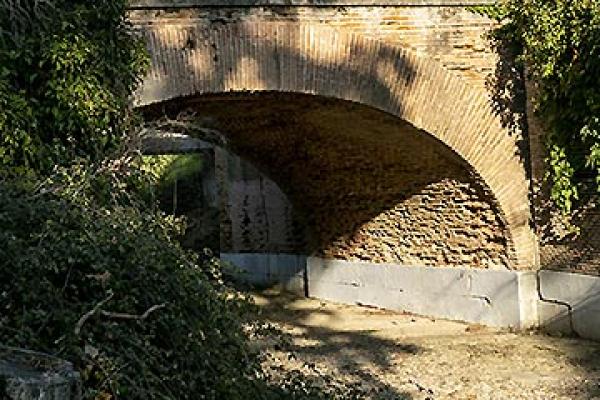
Once you have taken this path, it will cross through areas dotted with ash trees and holm oaks, until the Ventura Rodríguez bridge. This last section is, again, very busy with walkers, so it is important to exercise caution and accommodate other users.
Along it you may turn off onto some of the routes described above, trails devised for bicycle traffic, birdwatching, notable trees, wildlife, or those showcasing the history of water use in the area, and enjoy, by bicycle, the natural and cultural attractions cited in the previous descriptions.
Upon reaching the Puente de Ventura Rodríguez (bridge), it is necessary to go under the Pozuelo highway with your bicycle. Now in the Monte Sur, the trail continues, going up gentle but continuous slopes, towards the Montepríncipe housing development, and tracing its perimeter along a track that allows you to enjoy panoramic views of both the cool thalwegs and ash groves of this part of the woodland area, and the peaks of the Sierra de Guadarrama mountain range. In the spring and autumn the views are particularly spectacular, enhanced by the autumn's range of colors.
At the end of this track you will find a panoramic view to the west, with the Ciudad Grupo Santander complex standing out. At this point you take the Prado del Espino path to reach the Arroyo de la Fresneda wooden bridge, from where, on the left, you may proceed to the parking lot of the Palacio del Infante Don Luis.
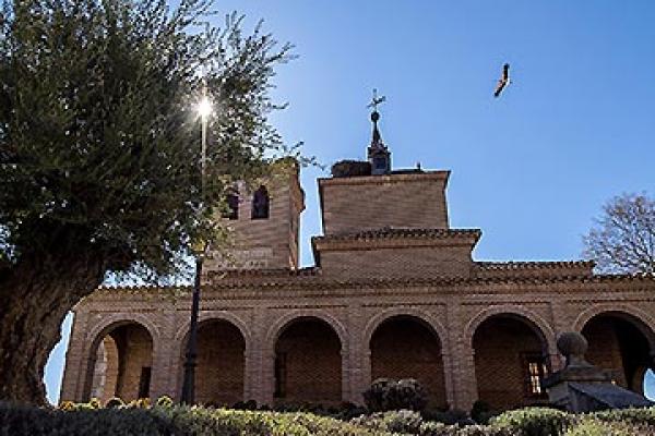
From this point, if you are feeling up to it, you can continue on and turn onto Boadilla's bike path, either at the Iglesia de San Cristóbal (church), whose tower is visible from the parking lot; or at the Aula Medioambiental (Environmental Classroom).
The Boadilla bike path stretches for 14.5 km, running throughout the entire municipality, including the historic center and long-established housing developments, Sector B, and the new developments of Valenoso, La Cárcava and El Pastel.